State of the Scheme: Nuneaton to Coventry via Bedworth
This website is made available free of charge and without adverts. While it's not here to make money, it does have costs. If you can throw a few pounds my way to help out, your support is gratefully received! Thank you!

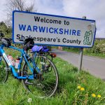
There is a scheme in Warwickshire to create an active travel corridor between the edge of Nuneaton through Bedworth and down to the border with Coventry – what should be a valuable and obvious backbone route for a cycling network. However, since the approval of funding within the County Council back in November 2019, there has been no public news or update on progress. So, having asked the question, here is an overview of the plan and the state of things as they stand now, two and a half years later.
Summarising the scheme
A scheme was originally announced (as far as I can tell) back in mid-2018 when it was reported in the local press that the County Council would submit a bid for funding to the Coventry and Warwickshire Local Enterprise Partnership (CWLEP) for a “super cycle route” – a bid that unfortunately failed. However, Warwickshire decided to press ahead by funding the £1.012m project itself, approved in November 2019. The County Council noted that the scheme was in the top-five of the highest priority routes in the county, and “a key cycle scheme to deliver local transport policies, Strategic Economic Policy objectives and the government’s ambition to double the current levels of cycling by 2025.”
Given how this scheme had been reported as a “super cycle route”, that funding was approved, and that Warwickshire County Council noted the importance of the scheme for “enabling access to cultural and sporting events including 2021 Coventry UK City of Culture and 2022 Commonwealth Games activities, by non-car modes”, it seemed reasonable to be hopeful that a good quality scheme would be developed over the coming couple of years. Sadly, the reality has not met those hopes.
The current plans
Two and a half years later, nothing has happened visibly. Information online is scarce, no press reports have been released, no plans have been published, and certainly nothing has happened on the ground. However, the project is still live according to information from the County Council which responded to a Freedom of Information Request. Plans are still in the preliminary design phase with difficulties being noted around junction interactions, land constraints and ecology. Unfortunately, the scheme remains roughly 18 months to two years away from completion.
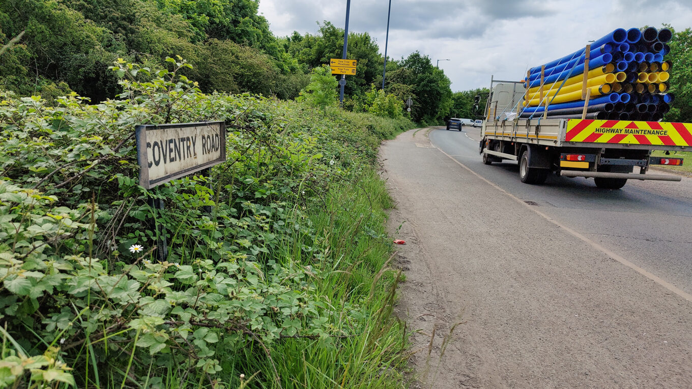
With the FoI Request, some details about the planned route have also been shared and clarified. Where it was reasonable perhaps to infer from press reports that the scheme would be a continuous cycle link along the Nuneaton-Bedworth-Coventry corridor, this is not the case. The funded scheme is in two separate and disconnected parts – a short section running from the Griff Roundabout at the north, connecting to existing shared infrastructure in the area, and running south along Coventry Road to the junction of Orchard Street on the northern edge of Bedworth (a distance of approximately 0.9km); and a larger section to the south of Bedworth running between Trelawney Road to the Gallagher Business Park and Coventry Canal (a forked route, approximately 2.1km in length).


There will be no connection through Bedworth itself to connect these two individual segments; although there is an intention to provide a link, nothing is formally funded or designed at this stage. Moreover, while there is an aspirational route alignment apparently identified as part of a cycle network development plan which would (if funded and developed) create a link, that route deviates away from the main road, runs along backstreets, alleyways and through parks. It is not a logical and easy to follow through route and is unlikely to be attractive at quiet times or after dark.
When it comes to the standards being employed, the County Council notes that given development began before the publication of the latest guidelines (LTN 1/20), while it is looking to use the highest standards possible given the constraints in the area, there is no guarantee that this scheme will be compliant with LTN 1/20.
A disappointing state so far
A route connecting the urban corridor that is Nuneaton to Coventry via Bedworth makes a lot of sense. The towns and the city are close together and easily cyclable in a reasonable time – even riding the full extent of the route. When this scheme was announced, I was very optimistic about the prospects – I want to be able to cycle safely and easily alone or with the family to Bedworth and beyond on a highly visible, easy to navigate, safe, all-weather route. Now, that optimism has been tempered somewhat given that the route will not (at this stage) provide that all-user connection between the centres of Nuneaton and Bedworth, that the standard may not be as good as originally hoped, and that the project seems to be stuck in its preliminary phase still maybe two years away from completion.
To counter that, the two distinct sections are important and useful links. But without a route through Bedworth itself – one that is obvious and direct – the benefits are limited. Bedworth is bereft of any cycle infrastructure, so without the ongoing link into the town itself, the northern most section especially is perhaps of limited appeal.
I want to see the full route, but I wonder whether going about the scheme in this piecemeal fashion is the best way forward. Perhaps it would be better to focus on creating a complete high quality link between Nuneaton and Bedworth town centres first, before looking to connect Bedworth to Coventry. This would at least then create a meaningful and useful link in the Nuneaton and Bedworth borough. The two town centres are only three miles apart (straight line) but cycling between them is difficult – National Cycle Network Route 52 doesn’t connect into Bedworth town centre, and that runs along Coventry Canal which can be a poor and isolated route especially in wetter, darker months.
Certainly, I think given the amount of time that has already passed, not building to current standards is a mistake. Bedworth has the A444 bypass running by it and so traffic should be discouraged from using Coventry Road except for local access. Road space should be reallocated to cycling on Coventry Road through Bedworth instead of suggesting riders deviate around back streets. There are understandable difficulties to the north where Coventry Road can get quite narrow, but then again it’s not a dense urban area and a very small acquisition of land would allow for reasonable (if not perfect) foot and cycle provision without introducing conflict. Yes, that might add to the costs but again, I would suggest focusing on one core route built to a high standard is perhaps more useful than the current approach of two disjointed sections. Get the first section done right, then come back and build the next part as a Phase 2 project later.
The Nuneaton connection
I’m also not overly impressed by the connection into Nuneaton at the northern limit of the scheme (Griff Roundabout). I had originally – mistakenly – assumed that the route was to continue to use Coventry Road heading east off the roundabout into Nuneaton. There is an existing shared use path that runs from Nuneaton’s Coton Arches to near Middlemarch Road and my original thought was this would be upgraded and extended. This would have created a complete main road link to Bedworth from Coton Arches, where other routes in Nuneaton also connect.

Instead, the northern limit of the scheme ends at the Griff Roundabout, itself which currently has shared use routes around it, and riders will connect to Nuneaton via St George’s Way where a new shared use path has been constructed as part of the controversial Bermuda Connection Project. This path then routes through to an existing connection into Middlemarch Road from which users can then pick up that existing path on Coventry Road to access Coton Arches.
The problem here is that the route between St George’s Way and Middlemarch Road is isolated and unattractive particularly after dark. It can be littered with glass and the access to Middlemarch Road itself is obstructed by a very narrow K-Frame barrier. The road here itself is quiet enough though the surface is awful in parts, but Coventry Road is a different matter. The shared use path here is extremely narrow for bidirectional riding – especially given overgrowth is often a problem – and it is only really suitable for south-bound, up hill, cycling. Crossing Coventry Road to connect between Middlemarch Road and the shared use path is also a poor experience – not one I’d recommend for children or slower/less confident riders, especially at busy times.

Middlemarch Road, Nuneaton
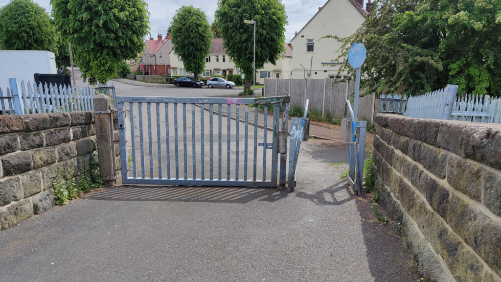
Middlemarch Road, Nuneaton
I can see a value in this route. It avoids a steep climb up Coventry Road towards Nuneaton, so it definitely has its uses but the above problems need to be addressed to make it more comfortable and safer – an isolated route should never trap people with obstructions like what are present here. However, a main road route on Coventry Road itself offers advantages where it is the more direct connection to the Griff Roundabout, the industrial areas there, and then the proposed route into Bedworth. So, I do think that not developing this main road route is another mistake.
The County Council does note that there is an aspiration separate to this scheme for a route to run along Gipsy Lane creating a connection with new developments there resulting in a broader east-west route that would also link into town via the existing Wembrook Trail off-road shared space. This will be valuable and should absolutely be provided – but it is not a direct route between the Griff Roundabout, Coton Arches, and therefore many other areas of Nuneaton.
Conclusion
At this point my expectations for what will be provided in this scheme are much reduced from what I envisaged when a “super cycle route” was announced. However, we don’t yet have detailed plans for the two sections that are currently in the preliminary design phase and as such it’s not fair to be overly critical of those segments – taken in isolation, they may yet prove to be excellent pieces of infrastructure. I have my doubts given the note from Warwickshire County Council that the designs may not meet the current standards, but it’s yet to be seen.
My criticisms are at the higher level – where the stated desire was to create a route that would contribute to government targets to double the levels of cycling by 2025, it looks like this scheme will fail in that objective – not least because that deadline is only three years away and this scheme is still estimated to have 18 months to two years to run before “completion”, but also cause it doesn’t offer a wide-reaching connection through Bedworth itself. The northern section ends just as it reaches the populated area and the town therefore continues to suffer from a near complete lack of meaningful and useful cycle routes.
Given that the County Council identified this route as one in the top five highest priority routes in the county, I’m very surprised at how the Council appears to be dragging its feet over this scheme (and others too) – it’s worth bearing in mind that in Coventry, developments are moving much faster with the nearly complete Coundon Cycleway being built over the last couple of years, and now the Binley scheme having commenced construction.
Warwickshire needs to start accelerating its projects and bringing these schemes to life, otherwise it’s reasonable to question its commitment. Yes, funding has been allocated for these two sections, but until we see changes on the ground, it’s meaningless. At this stage, we’re two and a half years in to a project which should have been completed by now, but we still have another eighteen months to two years to wait. If each scheme is going to take four years to develop, it will be decades before Warwickshire has anything approaching a fully-fledged integrated, well-connected active travel network.
That’s not good enough.
Have you found this content interesting or useful? If so, and if you are able to, any contributions are greatly appreciated! Thank you!